Feedback

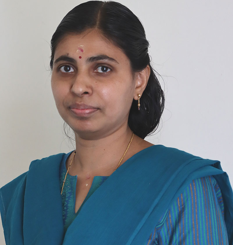
Prof. K Rajitha 

Assistant Professor,
Department of Civil Engineering

Applications of Artificial Neural Network for water quality modelling, GIS & Remote sensing, Mangrove phenology using satellite remote sensing, Remote sensing of agricultural crops, SAR image processing for wetland characterization, Satellite image based energy balance models, Water Resources Engineering
D-109, Civil Engineering Department
Birla Institute of Technology & Science, Pilani
Hyderabad Campus
NISA Hakimpet P.O
Dist.-Medchal Malkajgiri-500 078
Telangana, India

Journals, Conferences, Book Chapters and other publications

Journal Articles

  1. Cherian, S. M., & K, Rajitha. (2024). Random forest and support vector machine classifiers for coastal
    wetland characterization using the combination of features derived from optical data and synthetic
    aperture radar dataset. Journal of Water and Climate Change, 15(1), 29–49.
  2. Manne, M., & K, Rajitha. (2024). An inflection point-based method for estimating metrics of mangrove
    phenology combining climatic factors and landsat ndvi time series. Journal of Water and Climate
    Change, 15(5), 2059–2073.
  3. Satish, N., Anmala, J., Rajitha, K., & Varma, M. R. (2024). A stacking ann ensemble model of ml models
    for stream water quality prediction of godavari river basin, india. Ecological Informatics, 102500.
  4. Manne, M., Rajitha, K., Chakraborty, S., & Gnanamoorthy, P. (2023). A path analysis approach to model
    the gross primary productivity of mangroves using climate data and optical indices. Modeling Earth
    Systems and Environment, 1–14.
  5. Satish, N., Rajitha, K., Anmala, J., & Varma, M. R. (2023). Trophic status estimation of case-2 water
    bodies of the godavari river basin using satellite imagery and artificial neural network (ann). H2Open
    Journal, 6(2), 297–314.
  6. Cherian, S. M., & Rajitha, K. (2022). Analysis of polarimetric coherence data and derived roll-variant
    parameters of sentinel-1 data for discriminating mangrove types in pichavaram wetlands. Geocarto
    International, 1–19.
  7. Satish, N., Anmala, J., & Varma, M. R. R. (2022). Prediction of stream water quality in godavari river
    basin, india using statistical and artificial neural network models. H2Open Journal, 5(4), 621–641.
  8. Prakash Mohan, M., Rajitha, K., & Varma, M. R. (2020a). Integration of soil moisture as an auxiliary
    parameter for the anchor pixel selection process in sebal using landsat 8 and sentinel-1a images.
    International Journal of Remote Sensing, 41(3), 1214–1231.
  9. Prakash Mohan, M., Rajitha, K., & Varma, M. R. (2020b). Review of approaches for the estimation of
    sensible heat flux in remote sensing-based evapotranspiration models. Journal of Applied Remote
    Sensing, 14(4), 041501.
     
  10. Rajitha, K., Mukherjee, C., Vinu Chandran, R., & Prakash Mohan, M. (2010). Land-cover change
    dynamics and coastal aquaculture development: A case study in the east godavari delta, andhra pradesh,
    india using multi-temporal satellite data. International Journal of Remote Sensing, 31(16), 4423–4442.
  11. Vinu Chandran, R., Jeyaram, A., Jayaraman, V., Manoj, S., Rajitha, K., & Mukherjee, C. (2009).
    Prioritization of satellite-derived potential fishery grounds: An analytical hierarchical approach-based
    model using spatial and non-spatial data. International Journal of Remote Sensing, 30(17), 4479–4491.
  12. Rajitha, K., Mukherjee, C., & Chandran, R. V. (2007). Applications of remote sensing and gis for
    sustainable management of shrimp culture in india. Aquacultural Engineering, 36(1), 1–17.
Conference Proceedings
  1. Polimera, A. J., M M, P. M., & K, R. (2024). Performance assessment of neural radiance fields (nerf) and
    photogrammetry for 3d reconstruction of man-made and natural features. In Proceedings of the 16th
    international conference on agents and artificial intelligence (icaart 2024). Accepted as a Short Paper.
    INSTICC, Rome, Italy.
  2. Cherian, S. M., & Rajitha, K. (2021). Polarimetric coherence analysis for mangrove types discrimination
    of pichavaram, india using sentinel-1 satellite data. In 2021 ieee international geoscience and remote
    sensing symposium igarss (pp. 5195–5198). IEEE.
  3. Subramaniam, A., & Rajitha, K. (2019a). Estimation of the cardiac pulse from facial video in realistic
    conditions. In Icaart (2) (pp. 145–153).
  4. Subramaniam, A., & Rajitha, K. (2019b). Spectral reflectance based heart rate measurement from facial
    video. In 2019 ieee international conference on image processing (icip) (pp. 3362–3366). IEEE.
  5. MM, P. M., Rajitha, K., & Varma, M. R. (2018). A novel approach to select anchor pixels in sebal model
    by using inputs from sar images. In Igarss 2018-2018 ieee international geoscience and remote sensing
    symposium (pp. 7383–7386). IEEE.
  6. Mohan, M. P., Rajitha, K., & Varma, M. R. (2016a). Effect of pixel to pixel variation of zenith angles of
    sun on different model parameters of sebal. In Proceedings of national space science symposium held at
    vssc thiruvananthapuram, 9-12, february. VSSC Thiruvananthapuram.
  7. Mohan, M. P., Rajitha, K., & Varma, M. R. (2016b). Influence of interferometric coherence derived
    canopy height in sebal (surface energy balance algorithm for land. In Proceedings of isrs isg national
    symposium on recent advances in remote sensing and gis with special emphasis on mountain ecosystems
    december 7-9. ISRS ISG, Dehradun (India).
  8. Rajitha, K., Mohan, M. P., & Varma, M. R. (2015). Effect of cirrus cloud on normalized difference
    vegetation index (ndvi) and aerosol free vegetation index (afri): A study based on landsat 8 images. In
    2015 eighth international conference on advances in pattern recognition (icapr) (pp. 1–5). IEEE.
  9. Mohan, M. P., Rajitha, K., & Varma, M. R. (2014). Design optimisation of telescopic sub-mains in drip
    irrigation system. In Proceedings of international symposium on integrated water resources management,
    19-21, february. CWRDM, Kozhikode, India.
  10. Rajitha, K., Mohan, M. P., & Varma, M. R. (2014). Determination of potable water availability index
    using remote sensing and gis: A case study of hyderabad city. In Proceedings of international symposium
    on integrated water resources management, 19-21, february. CWRDM, Kozhikode, India.
  11. Mohan, M. P., & Rajitha, K. (2013). Satellite based temperature mapping: A case study of hyderabad city
    during the period 1999-2013. In Proceedings of national conference on “sustainable water resources
    planning, management and impact of climate change, 05-06, april. BITS-Pilani, Hyderabad Campus.
  12. Gupta, R., Rajitha, K., K, B., & Mittal, S. K. (2012). Application of gis in crime analysis: A gateway to safe
    city. In 14th annual international conference and exhibition on geospatial information technology and
    applications.
  13. Rajitha, K., Mukherjee, C., & Vinu Chandran, R. (2005). A gis and remote sensing based approach for
    assessing the impacts of shrimp culture on land cover changes. In Proceedings of 7th indian fisheries
    forum, november,2005.
  14. Rajitha, K., Mukherjee, C., & Vinu Chandran, R. (2004). Impact of shrimp culture on land cover changes
    using multi-temporal satellite imagery. a case study near kakinada bay, andhra pradesh, india. In
    Proceedings of international conference on agricultural and food engineering.
  15. Rajitha, K., Mukherjee, C., & Vinu Chandran, R. (2003a). Application of remote sensing and gis for
    sustainable development of shrimp culture along east coast of india. In 17 th national convention of
    agricultural engineers all india seminar on role of agricultural engineers in water conservation at kolakata
    12-13 december 2003. Institution of Engineers, Kolkata.
    16 Rajitha, K., Mukherjee, C., & Vinu Chandran, R. (2003b). Shrimp culture and mangrove deforestation. a
    case study near kakinada of andhra pradesh using remote sensing. In National conference on
    aquaculture. Institution of Engineers, Kolkata.
Book Chapter
Mohan, M. P., Rajitha, K., & Varma, M. R. (2022). Soil moisture estimation using a sar water cloud
model for an improved anchor pixel selection process in sebal. In Geospatial information handbook for
water resources and watershed management, volume iii (pp. 225–243). CRC Press.
 
Publications in Magazines
  1. Mohan, M. P., Rajitha, K., & Varma, M. R. (2022). Soil moisture estimation using a sar water cloud
    model for an improved anchor pixel selection process in sebal. In Geospatial information handbook for
    water resources and watershed management, volume iii (pp. 225–243). CRC Press.
  2. Rajitha, K., & Mohan, M. P. (2022). Solar induced chlorophyll fluorescence - a better predictor of crop stress
    through satellite remote sensing GIS Resources magazine Issue 1, March, 2022.
  3. Rajitha, K., & Mohan, M. P. (2017a). Open source satellite images in flood monitoring.do we need a liberal
    spatial data policy during disasters? GIS Resources magazine Issue 1, March, 2017.
  4. Rajitha, K., & Mohan, M. P. (2017b). Trinity in space for agriculture GIS Resources magazine Issue 3,
    September, 2017